Primero md15 – جهاز احترافي متكامل لكشف الذهب والمعادن والكنوز - الامارات
PRIMERO MD15 – جهاز احترافي متكامل لكشف الذهب والمعادن والكنوز
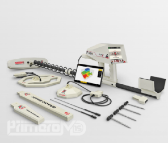
يُعد AJAX PRIMERO MD15 جهاز كشف احترافيًا متعدد الأنظمة، صُمم ليكون منصة متكاملة للبحث عن الذهب والذهب الخام والمعادن الثمينة والكنوز والفراغات والكهوف والأنفاق والمقابر والمياه الجوفية.
ويجمع الجهاز 15 نظام كشف متقدمًا في جهاز واحد، مع أنظمة للاستشعار والتصوير وتحليل التربة، بهدف إعطاء المستخدم معلومات أكثر شمولًا عن الهدف قبل اتخاذ قرار الحفر.
https://ajaxdetector.com/product-categories/gold-detectors/
أهم قدرات PRIMERO MD15
وفقًا للمواصفات المنشورة من AJAX، يجمع الجهاز بين:
● عمق كشف معلن يصل إلى 70 مترًا.
● مدى بحث أمامي معلن يصل إلى 3000 متر.
● أنظمة كشف وتصوير وتحليل متعددة.
● أداء مستقر في التربة المعدنية والمعقدة.
● أنظمة معايرة تساعد على تقليل التشويش والإشارات غير المرغوبة.
15 نظام كشف متكامل
تم تطوير PRIMERO MD15 ليعمل من خلال 15 نظام بحث، مما يجعله جهازًا متعدد الأنظمة يمكن استخدامه في مجموعة واسعة من عمليات الاستكشاف. وتذكر AJAX أن هذه الأنظمة تجمع بين تقنيات الكشف بعيد المدى والتصوير الأرضي والتحليل الجيوفيزيائي وغيرها.
1. نظام الكشف بعيد المدى
يوفر الجهاز نظامًا للكشف بعيد المدى يساعد المستخدم على البحث عن الأهداف في مساحات واسعة.
ويذكر المصنع نظامًا بمدى يصل إلى 3000 متر وعمق يصل إلى 70 مترًا ضمن مواصفات الجهاز العامة.
2. نظام الكشف بعيد المدى اليدوي
يوفر هذا النظام إمكانية التحكم في عملية البحث وإجراء إعدادات يدوية وفق نوع الهدف وظروف البحث.
وتوضح صفحة المنتج إمكانية تحديد نوع المعدن والعمق ومسافة البحث الأمامية.
3. نظام التصوير الأرضي
يُعد نظام Ground Imaging من الأنظمة الأساسية في PRIMERO MD15.
ويستخدم تقنيات التصوير الأرضي لإظهار المعلومات الموجودة أسفل سطح الأرض، مع إمكانية إنشاء صور ثنائية وثلاثية الأبعاد 2D/3D.
ويمكن للنظام المساعدة في تحليل:
● طبقات التربة.
● شكل الهدف.
● حجم الهدف.
● موقع الهدف.
● عمق الهدف.
● المعادن.
● الفراغات والتجاويف.
ويصل عمق التصوير الأرضي المعلن إلى 30 مترًا.
4. نظام Gradio Smart
تم تصميم Gradio Smart System للمسح العميق وتأكيد الأهداف.
ووفقًا للصفحة الرسمية، يمكن استخدامه:
● لتأكيد الأهداف حتى عمق 10 أمتار.
● لتحليل المجالات المغناطيسية المرتبطة بالمعادن.
● للكشف عن المعادن والفراغات.
ويُستخدم للبحث عن الكنوز والمعادن والفراغات الموجودة تحت الأرض.
5. نظام Live Scan
يوفر Live Scan عرضًا مباشرًا لنتائج المسح أثناء عملية البحث.
ويستخدم النظام ألوانًا مختلفة للمساعدة في قراءة النتائج:
● الأخضر: طبيعة التربة.
● الأحمر: المعادن.
● الأزرق: الفراغات والكهوف.
ويساعد ذلك المستخدم على متابعة منطقة البحث والحصول على بيانات مباشرة أثناء المسح.
6. نظام Ground Sonar
تم تصميم Ground Sonar System للفحص السريع قبل الانتقال إلى عمليات المسح المتقدمة.
ويعتمد على إرسال موجات قصيرة ومتتالية إلى الأرض وتحليل الإشارات المرتدة الناتجة عن اختلاف الكثافة.
ويمكن استخدامه للمساعدة في الكشف عن:
● الفراغات.
● الأنفاق.
● الكهوف.
● بعض الأجسام المعدنية.
كما يوفر إشارات مرئية وصوتية لدعم عملية تحليل منطقة البحث.
7. نظام التصوير والتحليل الأرضي المتقدم
يتميز الجهاز بنظام تصوير أرضي مدعوم بمعايرة ذكية وبرنامج Primero MD.
ويمكن للمستخدم قراءة النتائج:
● مباشرة من شاشة الجهاز.
● أو من خلال Tablet المرفق باستخدام برنامج Primero MD.
ويتيح البرنامج عرض وتحليل البيانات بطريقة مرئية، مع إمكانية دراسة شكل وحجم وعمق الهدف قبل الحفر.
التصوير ثنائي وثلاثي الأبعاد
يدعم PRIMERO MD15 تقنيات التصوير:
2D + 3D
وتساعد هذه التقنيات على عرض طبقات التربة والتمييز البصري بين بعض المعادن والفراغات، بالإضافة إلى عرض الأهداف بألوان وأشكال تساعد في تفسير نتائج المسح.
المعايرة الذكية حسب نوع التربة
يمكن معايرة الجهاز تلقائيًا أو يدويًا وفق طبيعة الأرض، ومنها:
● التربة الطينية.
● التربة الصخرية.
● التربة الرملية.
● التربة المختلطة.
● التربة المعدنية.
وتهدف المعايرة إلى:
● تصحيح قراءات الجهاز.
● تقليل التشويش.
● تقليل الإشارات الخاطئة.
● تحسين دقة نتائج المسح.
● تحقيق استقرار أفضل في البيئات الصعبة.
قراءة النتائج قبل الحفر
يتيح PRIMERO MD15 للمستخدم مراجعة نتائج المسح قبل اتخاذ قرار الحفر.
ويمكن قراءة البيانات على شاشة الجهاز أو باستخدام الجهاز اللوحي والبرنامج المخصص، مع إمكانية تحليل:
● موقع الهدف.
● شكل الهدف.
● حجم الهدف.
● العمق.
● طبيعة المنطقة المحيطة بالهدف.
الأهداف التي يدعمها الجهاز
وفقًا لصفحة AJAX، يمكن استخدام PRIMERO MD15 للبحث عن:
● الذهب.
● الذهب الخام.
● الفضة.
● النحاس.
● البرونز.
● الحديد.
● القصدير.
● الرصاص.
● الألومنيوم.
● النيازك.
● الألماس.
● الزمرد.
● المياه الجوفية.
● الفراغات.
البحث عن المياه الجوفية
يتضمن الجهاز نظامًا جيوفيزيائيًا مخصصًا للمساعدة في البحث عن المياه الجوفية.
ويعتمد النظام على تحليل خصائص التربة والمقاومة الكهربائية للمساعدة في تحديد المناطق التي قد تحتوي على مياه جوفية.
شاشة ملونة عالية الدقة
يأتي الجهاز بشاشة:
TFT Color LCD – 5 inches
بدقة:
800 × 480 WVGA
مع عمق ألوان 16-bit.
وتوضح الشركة أن الشاشة مناسبة للاستخدام في ظروف الإضاءة القوية وكذلك في البيئات المظلمة.
دعم 8 لغات
يدعم PRIMERO MD15 ثماني لغات:
● العربية.
● الإنجليزية.
● الفرنسية.
● الإسبانية.
● الألمانية.
● الروسية.
● التركية.
● الإيطالية.
البطارية ومدة التشغيل
يستخدم الجهاز بطارية قابلة لإعادة الشحن:
● 12 فولت
● 3300 مللي أمبير
وتذكر الصفحة الرسمية أن مدة الاستخدام النموذجية تتجاوز 6 ساعات في قسم الخصائص، بينما تذكر المواصفات الفنية مدة استخدام نموذجية تبلغ 10 ساعات؛ لذلك يُفضل اعتبار مدة التشغيل الفعلية مرتبطة بنظام البحث والإعدادات المستخدمة.
التخزين وحفظ عمليات المسح
وفق المواصفات الفنية المنشورة، يستطيع الجهاز حفظ ما يصل إلى 50 عملية مسح، مما يسمح للمستخدم بالاحتفاظ بنتائج سابقة ومراجعتها.
Bluetooth
يدعم الجهاز تقنية Bluetooth 2.4 GHz، مع حساسية تصل إلى -80 dBm وفق المواصفات المنشورة.
GPS والساعة
يحتوي الجهاز على ساعة حقيقية Real-Time Clock يمكن ضبطها يدويًا أو تلقائيًا باستخدام وقت GPS.
وهذا يساعد في تنظيم بيانات عمليات المسح وتسجيلها وفق التاريخ والوقت.
حماية الجهاز
يوفر الجهاز نظام حماية من خلال PIN قابل للتخصيص، مما يتيح للمستخدم تقييد الدخول إلى الجهاز.
التصميم الميداني
تم تصميم PRIMERO MD15 باستخدام مواد قوية وخفيفة، ومنها ألياف الكربون.
ويتميز بتصميم مريح للاستخدام الميداني، مع قبضة وتوازن يساعدان على تقليل الإجهاد أثناء عمليات البحث الطويلة.
كما يمكن فك وتركيب أجزاء الجهاز لتسهيل النقل والتخزين.
البيئات المناسبة للاستخدام
تذكر AJAX أن الجهاز تم اختباره في أنواع مختلفة من التربة، ومنها:
● الصحاري الجافة والرملية.
● المناطق الجبلية والصخرية.
● الأراضي الزراعية والسهول.
● الغابات والمناطق الرطبة.
● التربة الطينية.
● التربة شديدة التمعدن.
● المواقع الأثرية والتاريخية.
المواصفات الفنية
المواصفة التفاصيل
أنظمة الكشف 15 نظامًا
أقصى عمق معلن 70 مترًا
مدى البحث المعلن 3000 متر
عمق Gradio Smart 10 أمتار
عمق التصوير الأرضي 30 مترًا
الشاشة TFT Color LCD
حجم الشاشة 5 بوصات
الدقة 800 × 480 WVGA
الألوان 16-bit
البطارية 12V – 3300mAh
مدة التشغيل تختلف حسب الاستخدام؛ المواصفة المنشورة 10 ساعات
التخزين حفظ حتى 50 عملية مسح
الصوت MP3 – 32 Kbit/s
Bluetooth 2.4 GHz
اللغات 8 لغات
GPS مدعوم
الحماية PIN قابل للتخصيص
الأبعاد 88 × 52 × 20 سم
وزن العبوة حوالي 10.2 كجم
حرارة التشغيل من -10°C إلى 60°C
حرارة التخزين من -10°C إلى 80°C
الرطوبة حتى 90%
المواصفات مبنية على بيانات صفحة المنتج الرسمية لـ AJAX، مع ملاحظة وجود اختلاف في الصفحة نفسها بين مدة التشغيل المذكورة في قسم الخصائص والمذكورة في جدول المواصفات.
أهم مميزات AJAX PRIMERO MD15
● 15 نظام كشف متكامل.
● عمق معلن يصل إلى 70 مترًا.
● مدى بحث معلن يصل إلى 3000 متر.
● أنظمة تصوير أرضي 2D و3D.
● نظام Live Scan.
● نظام Ground Sonar.
● نظام Gradio Smart.
● نظام جيوفيزيائي للمياه والمعادن.
● تحليل طبقات التربة.
● معايرة ذكية حسب نوع التربة.
● البحث عن الذهب والذهب الخام.
● البحث عن المعادن الثمينة.
● الكشف عن الفراغات والكهوف والأنفاق والمقابر.
● البحث عن المياه الجوفية.
● شاشة ملونة 5 بوصات.
● دقة 800 × 480 WVGA.
● دعم 8 لغات، من بينها العربية.
● بطارية 12V – 3300mAh.
● Bluetooth.
● GPS.
● ذاكرة لحفظ عمليات المسح.
● برنامج Primero MD مع جهاز Tablet لتحليل النتائج.
● تصميم قوي وخفيف باستخدام ألياف الكربون.
● ضمان لمدة عامين مع دعم فني من AJAX.
الخاتمة
يقدم AJAX PRIMERO MD15 منظومة متكاملة تجمع 15 نظام كشف في جهاز واحد، مع تقنيات التصوير الأرضي ثنائي وثلاثي الأبعاد، والمسح المباشر، والسونار الأرضي، والكشف بعيد المدى، والتحليل الجيوفيزيائي.
وبفضل قدراته المعلنة التي تصل إلى 70 مترًا من العمق و3000 متر من مدى البحث، إضافة إلى أنظمة تحليل التربة والمعايرة الذكية وبرنامج Primero MD، تم تصميم الجهاز ليكون أداة احترافية لعمليات البحث والاستكشاف عن الذهب والمعادن والكنوز والفراغات والمياه الجوفية.
نفس انجليزي
AJAX PRIMERO MD15 – Professional Multi-System Gold, Treasure and Metal Detector
The AJAX PRIMERO MD15 is a professional multi-system detector designed for searching for gold, gold nuggets, precious metals, buried treasures, underground cavities, caves, tunnels, graves, and groundwater.
The device combines 15 advanced detection systems in one platform, providing different technologies for long-range detection, ground imaging, scanning, target analysis, and geophysical exploration.
best gold detector
15 Integrated Detection Systems
The PRIMERO MD15 combines multiple specialized detection technologies, including:
● Long-Range Detection System.
● Manual Long-Range Detection.
● Ground Imaging System.
● 2D and 3D Ground Imaging.
● Gradio Smart System.
● Live Scan System.
● Ground Sonar System.
● Geophysical Detection System.
● Pulse Induction technology.
● Spectrum analysis.
● Ground and target analysis systems.
● Additional integrated search functions.
This multi-system configuration allows users to select different detection methods according to the target and ground conditions.
Long-Range Detection System
The Long-Range Detection System is designed for searching over large areas.
The manufacturer states a maximum search depth of up to 70 meters and a forward search distance of up to 3,000 meters for the device's long-range capabilities.
The system is designed to search for targets including:
● Gold.
● Gold nuggets.
● Silver.
● Copper.
● Bronze.
● Iron.
● Tin.
● Lead.
● Aluminum.
● Meteorites.
● Diamonds.
● Emeralds.
● Groundwater.
● Underground cavities.
Manual Long-Range Detection
The manual long-range system provides users with greater control over the search process.
Depending on the search conditions, the user can adjust parameters such as:
● Target type.
● Search depth.
● Forward search distance.
This allows the detector to be configured according to the intended search target.
Ground Imaging System
The Ground Imaging System is one of the main technologies incorporated into the PRIMERO MD15.
It analyzes underground information and can generate 2D and 3D images of the scanned area.
The system can assist in analyzing:
● Underground layers.
● Target shape.
● Target size.
● Target location.
● Target depth.
● Metals.
● Underground cavities.
The manufacturer's stated maximum imaging depth is 30 meters.
2D and 3D Ground Imaging
The PRIMERO MD15 supports both:
2D Ground Imaging + 3D Ground Imaging
These imaging technologies are designed to provide a visual representation of underground scan data and help users analyze potential targets and ground structures.
The results can be displayed using different colors and visual representations to make the scanned data easier to interpret.
Gradio Smart System
The Gradio Smart System is designed for deep scanning and target confirmation.
According to the manufacturer's information, the system can be used to:
● Confirm targets down to a stated depth of 10 meters.
● Analyze magnetic-field responses associated with buried metals.
● Search for metals.
● Identify underground cavities.
Live Scan System
The Live Scan System provides real-time information while the ground is being scanned.
Different colors are used to assist with interpreting the scan:
● Green: Soil.
● Red: Metals.
● Blue: Cavities and caves.
This allows users to monitor the scanning results while moving through the search area.
Ground Sonar System
The Ground Sonar System is designed to provide a rapid preliminary examination of the ground.
It sends short, repeated signals into the ground and analyzes the returned responses caused by differences in underground density.
The system can assist in searching for:
● Cavities.
● Tunnels.
● Caves.
● Certain buried metallic objects.
The results are presented through visual and audio indicators to support target analysis.
Advanced Ground Imaging and Analysis
The PRIMERO MD15 includes advanced ground-imaging and analysis capabilities supported by the Primero MD software.
Search data can be viewed:
● Directly on the detector's display.
● On the supplied tablet using the Primero MD software.
The software provides visual tools for analyzing scan data and examining potential target characteristics before excavation.
Intelligent Ground Calibration
The detector can be calibrated automatically or manually according to ground conditions, including:
● Clay soil.
● Rocky soil.
● Sandy soil.
● Mixed soil.
● Highly mineralized soil.
Ground calibration is designed to:
● Correct detector readings.
● Reduce interference.
● Reduce false signals.
● Improve scan stability.
● Provide more consistent results in challenging environments.
Target Analysis Before Excavation
The PRIMERO MD15 allows users to review scan information before deciding whether further investigation is necessary.
The results can provide information regarding:
● Target location.
● Target shape.
● Target size.
● Estimated depth.
● Surrounding underground conditions.
Detection Targets
According to AJAX's published product information, the PRIMERO MD15 can be used to search for:
● Gold.
● Gold nuggets.
● Silver.
● Copper.
● Bronze.
● Iron.
● Tin.
● Lead.
● Aluminum.
● Meteorites.
● Diamonds.
● Emeralds.
● Groundwater.
● Underground cavities.
Groundwater Detection
The device includes a geophysical system designed to assist with groundwater exploration.
The system analyzes soil characteristics and electrical resistance to help identify areas that may contain underground water.
High-Resolution Color Display
The PRIMERO MD15 features a:
5-inch TFT Color LCD
with:
800 × 480 WVGA resolution
and 16-bit color depth.
The display is designed to provide clear information in both bright outdoor environments and darker conditions.
8-Language Support
The detector supports eight languages:
● English.
● French.
● Spanish.
● German.
● Russian.
● Arabic.
● Turkish.
● Italian.
Battery and Operating Time
The PRIMERO MD15 uses a rechargeable:
12V – 3300mAh battery
The manufacturer lists typical operating time of approximately 10 hours in the technical specifications, while another section of the product information states more than 6 hours depending on operation.
Actual battery life can therefore vary according to the detection system, settings, and operating conditions.
Scan Storage
The device can store up to 50 scan operations, allowing users to save previous scan information for later review and analysis.
Bluetooth Connectivity
The PRIMERO MD15 supports 2.4 GHz Bluetooth connectivity, with published sensitivity of up to -80 dBm.
GPS and Real-Time Clock
The device includes a built-in Real-Time Clock.
The time can be configured manually or automatically using GPS time, helping users organize scan records according to date and time.
PIN Security
The PRIMERO MD15 includes a customizable PIN protection system that allows users to restrict access to the detector.
Durable Field Construction
The detector uses strong and lightweight materials, including carbon fiber.
Its design is intended for field use, while the adjustable components make transportation and storage easier.
The packaging is also designed to protect the equipment from dust and humidity.
Suitable Ground Conditions
The PRIMERO MD15 is designed for use across different environments, including:
● Dry sandy deserts.
● Mountainous and rocky areas.
● Agricultural land and plains.
● Forests and humid environments.
● Clay soils.
● Highly mineralized soils.
● Archaeological and historical locations.
Technical Specifications
Specification Details
Detection Systems 15 integrated systems
Maximum Stated Depth 70 meters
Maximum Stated Search Distance 3,000 meters
Gradio Smart Depth 10 meters
Ground Imaging Depth 30 meters
Display TFT Color LCD
Display Size 5 inches
Resolution 800 × 480 WVGA
Color Depth 16-bit
Battery 12V – 3300mAh
Operating Time Approximately 10 hours, depending on use
Scan Storage Up to 50 scans
Audio MP3 – 32 Kbit/s
Bluetooth 2.4 GHz
Languages 8
GPS Supported
Security Customizable PIN
Dimensions 88 × 52 × 20 cm
Package Weight Approximately 10.2 kg
Operating Temperature -10°C to 60°C
Storage Temperature -10°C to 80°C
Humidity Up to 90%
Key Features of AJAX PRIMERO MD15
● 15 integrated detection systems.
● Stated maximum depth of 70 meters.
● Stated search distance up to 3,000 meters.
● 2D and 3D ground imaging.
● Live Scan technology.
● Ground Sonar system.
● Gradio Smart system.
● Geophysical groundwater and metal detection.
● Ground-layer analysis.
● Intelligent ground calibration.
● Gold and gold nugget detection.
● Precious metal detection.
● Underground cavity detection.
● Cave and tunnel exploration.
● Groundwater exploration.
● 5-inch color display.
● 800 × 480 WVGA resolution.
● Support for 8 languages.
● Rechargeable 12V – 3300mAh battery.
● Bluetooth connectivity.
● GPS support.
● Scan data storage.
● Primero MD software and tablet-based analysis.
● Strong carbon-fiber construction.
● 2-year manufacturer warranty.
Conclusion
The AJAX PRIMERO MD15 combines 15 detection systems into one professional platform, integrating long-range detection, 2D and 3D ground imaging, Live Scan, Ground Sonar, Gradio Smart, geophysical analysis, and advanced ground calibration.
With manufacturer-stated capabilities of up to 70 meters in depth and 3,000 meters in search distance, together with advanced imaging, target-analysis software, multilingual support, rechargeable power, Bluetooth, GPS, and scan storage, the PRIMERO MD15 is designed as a comprehensive platform for professional field exploration and the search for gold, metals, buried targets, underground cavities, and groundwater.


 135
135